Irrigation View Widget
Description
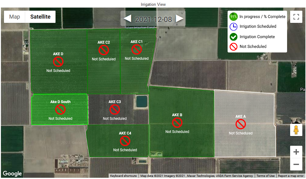
The Irrigation View widget can display the status of user defined fields (when zoomed in on the ranch). One of four statuses will be shown for each field; Scheduled, Not Scheduled, Complete or In progress (with % complete). The current day is shown by default and the date is displayed at the top, center of the map. Forward and backward arrows allow the user to view the irrigation status 13 days into the past or future.
Features / Options
- Icons indicate the status for each field
- View current day, or page forward/backwards up to 13 days
General Dashboard and Widget info
Features common to all Widgets and general Dashboard info can be found in the HotSpot widget section of the manual.
Widget Editor Settings
Widget name
Appears top and center of widget.
Default map type
Use the drop-down-menu to select the preferred map type; Road Map, Satellite, Hybrid, or Terrain
Render areas
Check the box to make user defined (highlighted fields) areas appear on the map.
Cross Account Boundaries
Check this box if you wish to see items from sub accounts
Group Crawl Depth
This setting determines how far down a branch of the group tree the widget will look for assets and defined areas
On Screen Controls / Functions
Map/Satellite
Click to map type to switch to and from default map view.
Full Screen/Normal
Click the frame icon in the upper right corner to enter or exit full screen view
Street view
Click the “Pegman” (Google's street view icon) to see possible street level views. This view also provides links to open in map or street view in a new new tab. Use the back arrow (upper left) to return to overhead view.
Zoom
Use your mouse's scroll wheel or the “+” / “-” buttons (lower right) to zoom in or our. When scrolling, position your cursor over the point you wish to zoom to.